
Streets for people
Proposed 20 ft total woonerf corridors: shared paving, no raised curbs or driveway cuts, with entrances connected throughout the district.
 COURTYARD
CARLTON COUNTY, MINNESOTA
A neighborhood of small buildings, generous family homes and green courtyards. Built around the simple pleasure of walking.
Explore the neighborhoodA Courtyard Urbanist concept · October 2026
01 / THE VISION
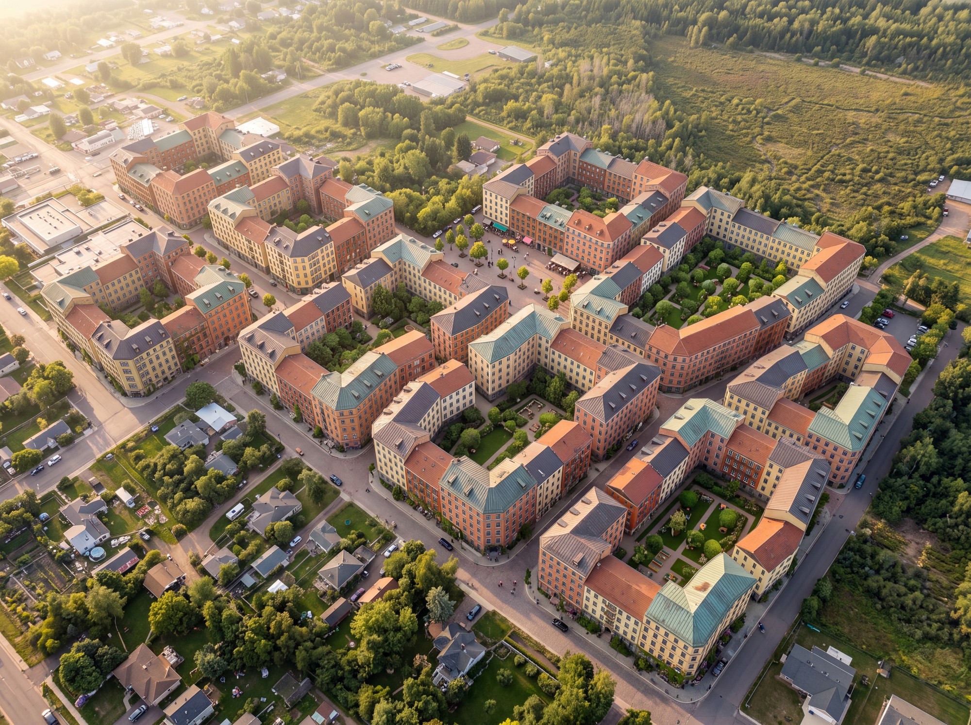
Reimagine the former school campus as a compact, welcoming neighborhood: front doors on friendly streets, everyday destinations at the corners, and gardens just beyond the buildings.
The proposal pairs traditional Helsinki architecture with Minnesota’s material character. Four-story buildings form the middle of each block; five-story corners mark intersections. Standing-seam metal roofs, warm masonry colors, dormers, bay windows and recessed loggias give each building its own identity.
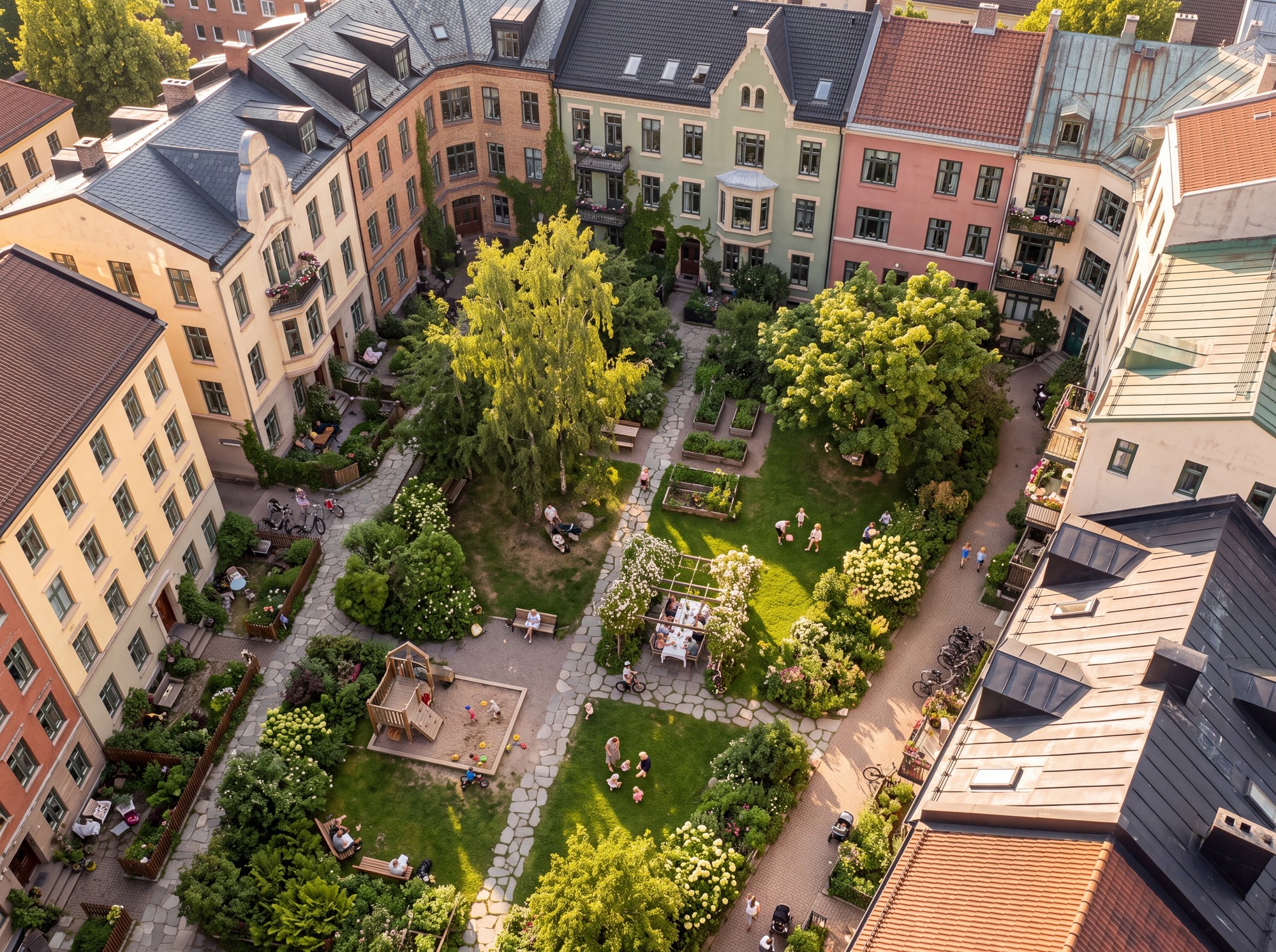
A public piazza and flush shared streets make room for meeting, strolling and neighborhood life. Inside the blocks, planted resident courtyards offer space to grow food, gather at a picnic table and play in the sand.
Proposed 20 ft total woonerf corridors: shared paving, no raised curbs or driveway cuts, with entrances connected throughout the district.
Protected resident gardens, 24 raised beds, eight sandboxes and 13 picnic tables. Public life centers on the paved piazza.
Independent buildings with one compact stair each. A mix of simple four-story middles and five-story corners with elevators.
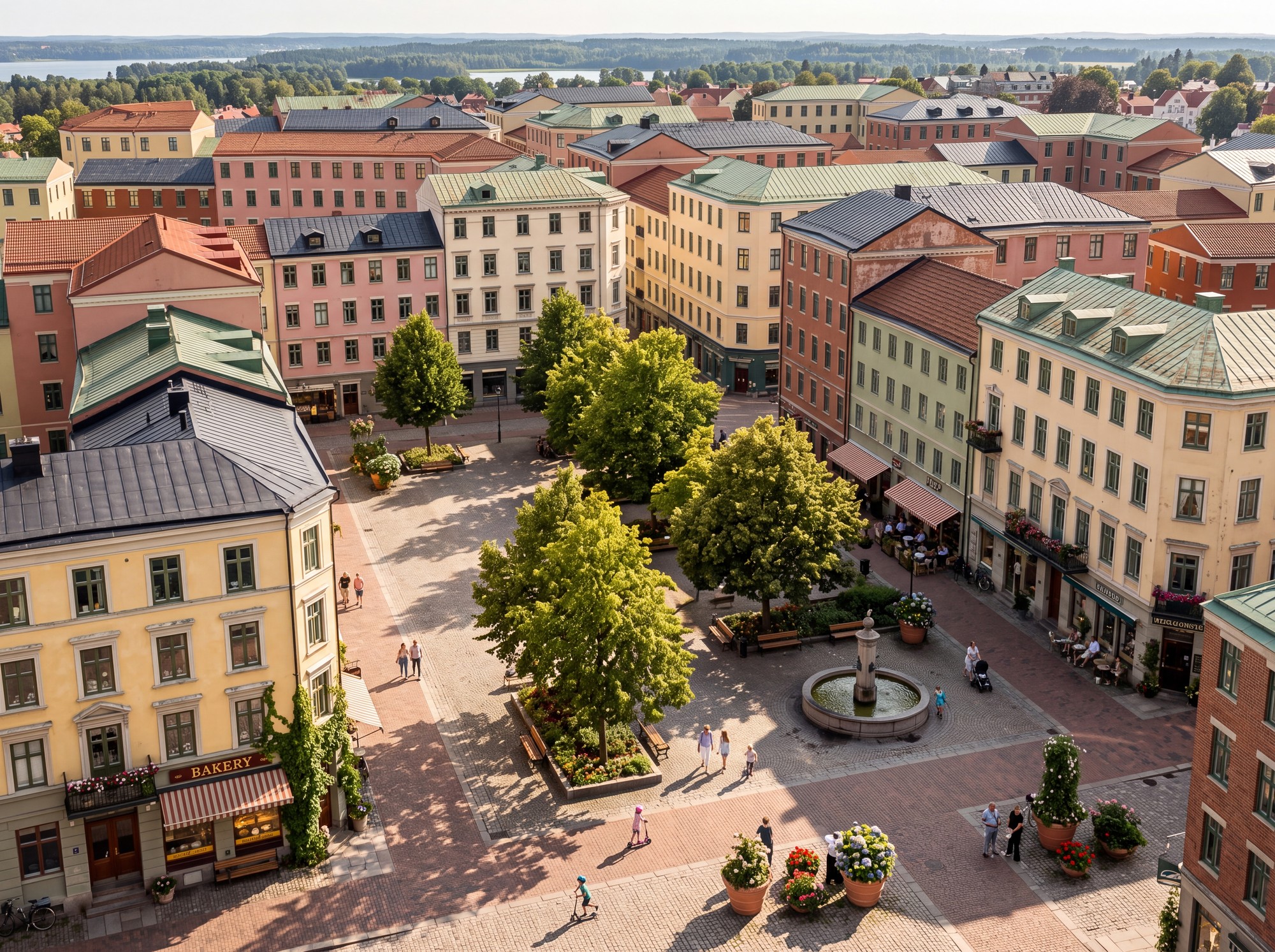
THE PUBLIC PIAZZA
Neighborhood shops and cafés open onto a welcoming paved square, with shade, seating and room for everyday life.
Illustrative vision02 / WALK THROUGH THE IDEA
Fly around the proposal in Google Earth, from the wider Carlton landscape to the plaza, gardens and shared streets. Then explore the interactive model at your own pace.
CARLTON IN ITS SETTING
Explore the Carlton courtyard neighborhood concept in Google Earth. The flight visits the public piazza, planted courtyards, 20-foot shared streets and proposed County addition.
Download the video ↓EXPLORE AT YOUR OWN PACE
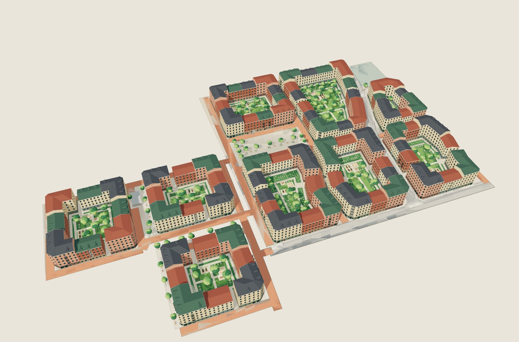
Rotate, zoom and pause anywhere in the design model.
90-SECOND GUIDED 3D TOUR
Ready to play
Drag or zoom to pause and explore. This flight uses the M19 design model; download the Google Earth tour to see it over satellite imagery.
Model M19 · 82 buildings · 35 corner elevators · 47 four-story walk-ups
Open full model03 / THE SITE & THE BUILDINGS
The study includes the four school-campus parcels and the separate County parking parcel to the west. Existing public streets connect the parts; proposed woonerfs complete the local network.
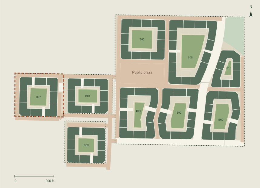
Gross floor area includes walls and shared space. Commercial areas are study reservations at intersections; tenants and demand are not established.
Site areas are measured from Carlton County GIS parcel geometry retrieved October 11, 2026; rounded components may not sum exactly. These are approximate planning measurements, not a boundary survey. Existing public rights-of-way are not added to the 13.43 acres.
04 / HOMES FOR EVERY CHAPTER
A 1,000 sq ft average apartment, with half of all homes offering three or four bedrooms. Smaller one- and two-bedroom homes balance the mix.
PRELIMINARY HOUSING ESTIMATE
Working range: ~780–880 homes
An area-based planning estimate, not a count of fitted apartment plans. The mix below is an illustrative allocation of the rounded 830-home scenario.
| Home type | Size | Share | Homes |
|---|---|---|---|
| 1 bedroom | 600 sq ft | 30% | 249 |
| 2 bedrooms | 850 sq ft | 20% | 166 |
| 3 bedrooms | 1,200 sq ft | 40% | 332 |
| 4 bedrooms | 1,700 sq ft | 10% | 83 |
| Total / average | 1,000 sq ft | 100% | 830 |
The 40% three-bedroom / 10% four-bedroom split and the smaller-home sizes are provisional study assumptions. Half of all homes remain three- or four-bedroom homes.
The common-space allowance includes the modeled cores; they are not deducted twice. No extra homes are assumed in dormers, attics, basements or roofs. Detailed plans may change the efficiency, apartment mix and total.
homes
Sensitivity only. This changes the area-based estimate, not the design or the illustrative bedroom mix above.
KEEP EXPLORING
Continue in Google Earth Pro to see the neighborhood in its real geographic setting. Download the complete M19 model with its 90-second camera tour.
Download the 90-second Earth tourKMZ · 19.8 MB · Ground-level M19 model included · E02 correction. Plays in Google Earth Pro on a computer; video export is a separate step.
Keep Google Earth and imagery credits visible in the finished video.
Download the instructions ↓A WORKING CONCEPT
This proposal assumes replacement of the school, inclusion of the separately controlled County parking parcel, and relocation of Public Works functions to create the plaza. Land availability and retained uses still need confirmation.
Housing yield, single-stair arrangements, accessibility, emergency access, utilities, wetland constraints and winter operations require further design and review. The northern wetland area remains a review hold in this version.
Prepared by Courtyard Urbanist for discussion. This is an independent concept, not an adopted Carlton County or City of Carlton plan.