


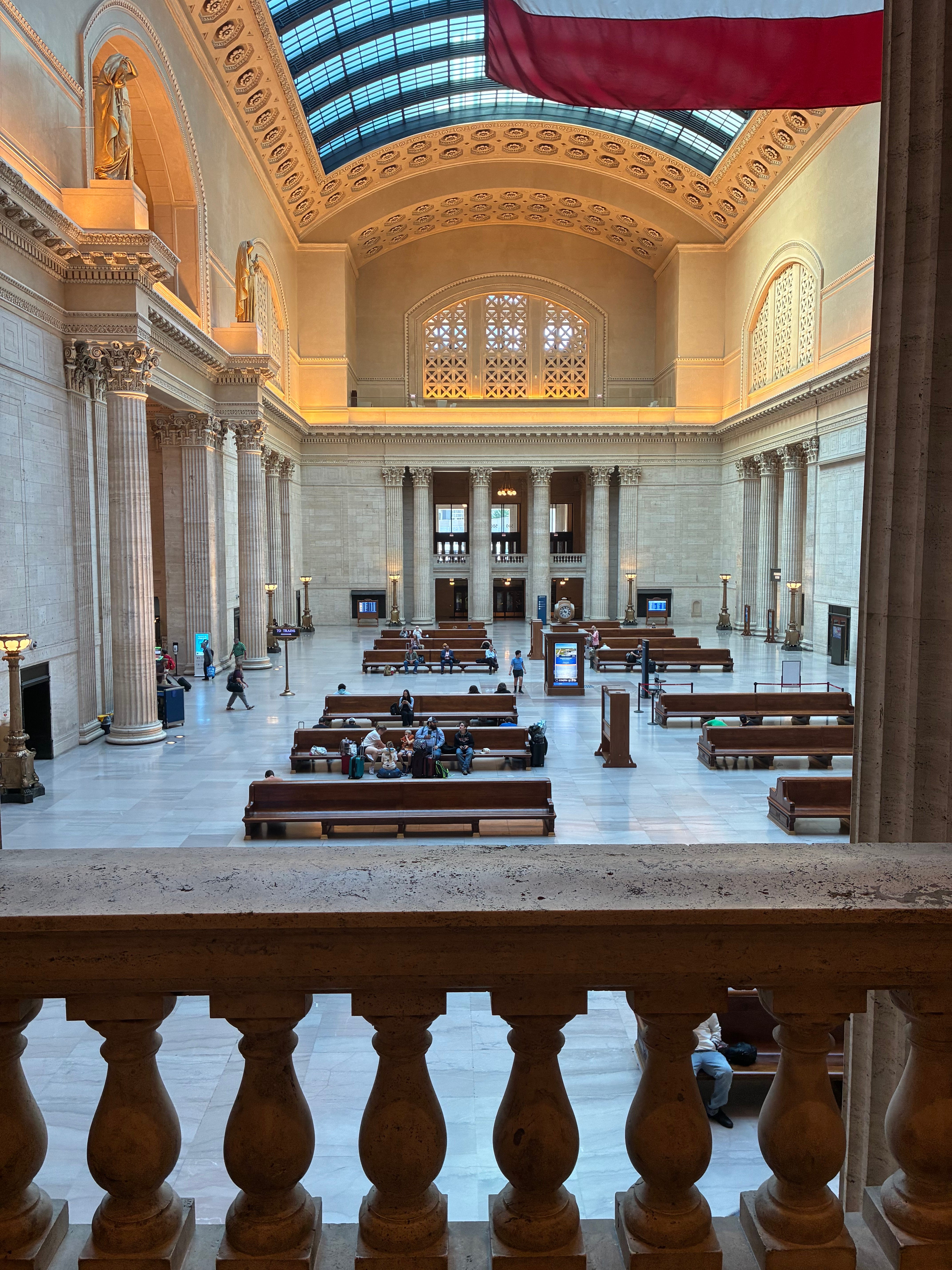
On July 23rd, I boarded a train at Chicago’s Union Station bound for Normal, Illinois.
Strong Towns BLONO had invited me to give the keynote address at the public kickoff of its 2026 Downtown Bloomington Transitional District Charrette. The evening began with an open public-engagement session, followed by my talk, “Courtyard Urbanism: Building Cities for Families,” in the courtroom at the McLean County Museum of History. The next day, a smaller group spent hours walking downtown, studying its parcels, drawing on maps, and imagining what a repaired downtown Bloomington could look like.
The event was organized around the important question of what should happen in the “transitional areas” surrounding downtown Bloomington?
Downtown Bloomington has an urban core that is mainly commercial and is surrounded by under-developed areas that, ideally, evolve into a denser, mixed-use transition neighborhood between the urban core and the lower-density residential neighborhoods. The vacant and underdeveloped areas already have streets and infrastructure. But they are visually dominated by surface parking lots and leftovers of the car-oriented development model that hollowed out so many American downtowns in the second half of the twentieth century.


A charrette exists to make a different future visible. It gets people out of the abstract language of “density” and “revitalization” and models buildings on familiar sites. Charrettes help people to imagine what a rebuilt downtown could look like. That makes a charrette one of the best tools for introducing courtyard urbanism to a place that hasn’t seen it before.


Bloomington-Normal needs live-work neighborhoods for a changing workforce and growing employment
Remember: cities exist to put people in close proximity to jobs and to their social and cultural networks. With ~135,000 residents and home to State Farm Insurance and Rivian, Bloomington-Normal has a large population and strong regional employment, but it largely fails to put its residents close to their jobs and social networks, forcing them into isolation and car dependency.
Unlike the fading small towns held up as romantic comeback stories, BLONO isn’t hunting for a reason to exist. Its employment base is growing and the demand for housing is strong. However, although the employment base is growing, the need for single-use office space, downtown, sitting on land far away from workers’ homes is declining rapidly.
This is the same national story I’ve written about before. U.S. office vacancy has plateaued at roughly double its pre-pandemic level. A quarter of the country’s paid workdays now happen at home. And the households doing that work look nothing like the ones this downtown was built around. Among married couples with children, both parents work in 66.3 percent of families today, up from about a quarter in 1960. When both adults hold jobs, flexibility stops being a perk and becomes the schedule.


State Farm doesn’t need fewer workers. It needs less downtown square footage per worker. Fewer of those 13,000 people are in that building at 10 a.m. on a Tuesday than at any point in the company’s history.
I heard the flip side of that shift firsthand during Friday’s charrette. A mother of two — a one-year-old and a four-year-old — who works at State Farm told me at length about her frustration with the car culture grind, where the most stressful part of her day is wrestling her kids into carseats to take them to daycare and other desinations. She wasn’t asking for a bigger house farther out. She wanted to walk her kids to school and get to work herself without the car seats.
Walkable, family-friendly density does not exist in Bloomington-Normal. There are houses for families in low-density subdivisions, and there are student apartments, downtown lofts, and some new yardless corridor buildings. Nowhere can you find fine-grained neighborhoods made of many small apartment houses, townhouses, small mixed-use buildings, courtyards, streets, parks, schools, and local businesses.
This housing stock reflects the automobile-oriented patterns of the mid-twentieth century in the Twin Cities. Older walkable neighborhoods were neglected while housing and commercial activity dispersed outward. Downtown Bloomington kept its civic and architectural assets, but the continuous urban fabric around them thinned out.
Uptown Normal shows the trajectory can be reversed. Its redevelopment — a 1999 masterplan by the Chicago firm Farr Associates, more than two decades of infrastructure investment, the Uptown Circle roundabout, a multimodal Amtrak and bus station — brought apartments, hotels, transit, public space, shops, and civic life back to its center. It’s an accomplishment that required that the local government spend enormous political and financial capital to see it through.


But Uptown’s next phase reminds us that density alone is not sufficient to make a great or even viable neighborhood.
The weakness of conventional megaprojects; the strength of the building-and-block model
Much recent American densification follows what you could call the superparcel model: assemble a large site, hand it to a single developer, and build one large building — or one connected podium complex — designed, financed, approved, and managed as a single project.
Remarkably, these projects can add hundreds of apartments without creating a neighborhood. The long blank walls, few entrances, internally oriented amenities, narrow demographic, limited usable yard space, limited ownership and development participation … all of these forces make such projects feel incomplete and sterile. They feel designed for throughput and cars rather than long-term occupancy and pedestrian activity.
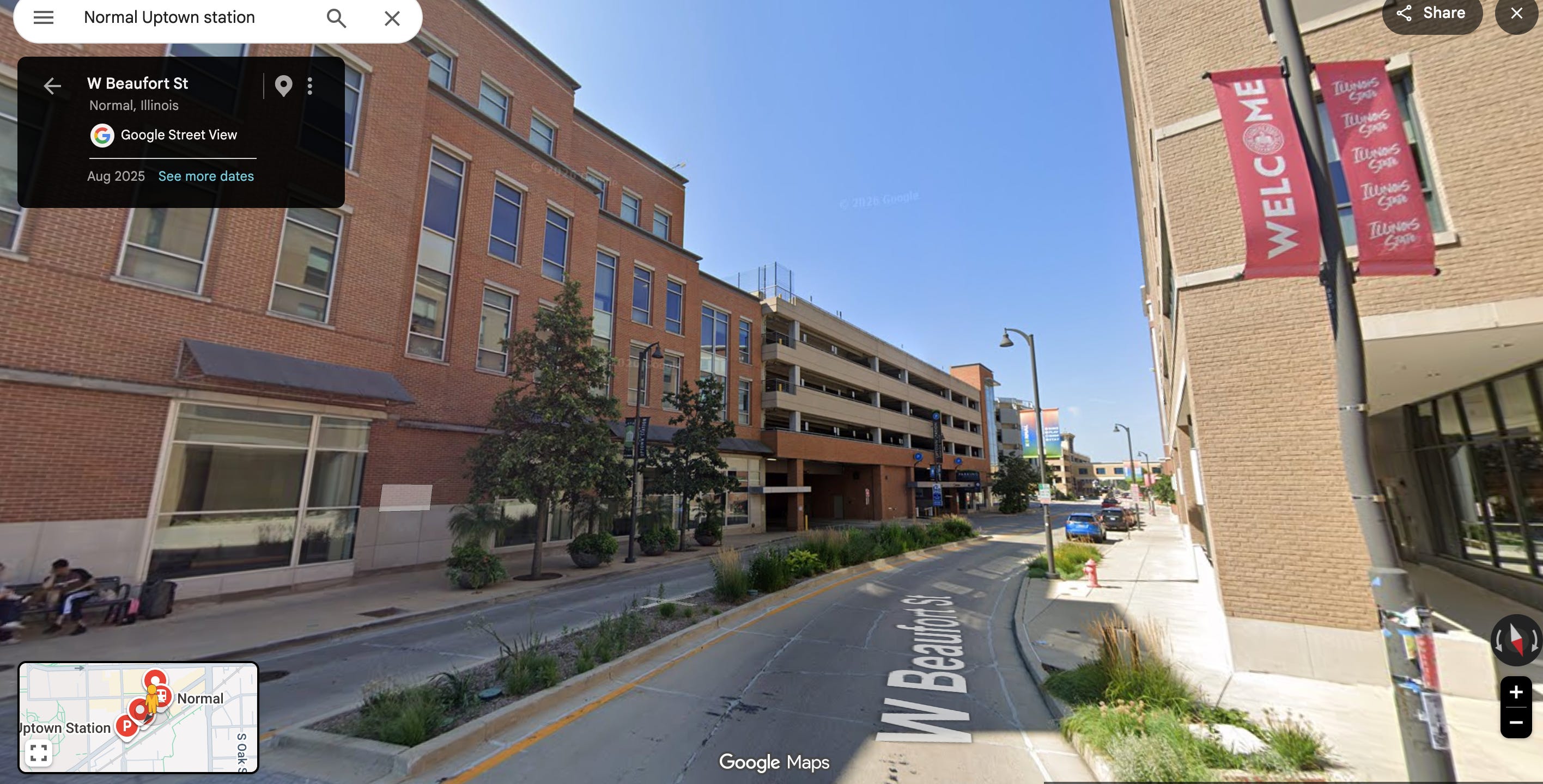
Noah Tang, the president of Strong Towns BLONO, has made this case in detail writing about Uptown Normal’s Trail East and West sites. Two development proposals for those parcels collapsed in the past decade — a five-story, roughly $30 million building from an out-of-state firm that fell apart on financing in 2021, then a two-building, 150-unit, $50–60 million proposal from another out-of-town developer that went quiet by 2023. Tang's diagnosis is blunt: "Trying to assemble a capital stack of cards for a project of $30 million dollars is a tall order, and pretty much anything can knock this fragile metaphor of financing down." His alternative is to subdivide the same land into 20-to-40-foot parcels sold with design covenants — closer to the width of Uptown’s own successful blocks — so no single deal has to carry the whole neighborhood. His point isn’t that Uptown should stop growing. It’s that the physical and financial structure of its growth matters as much as the growth itself.
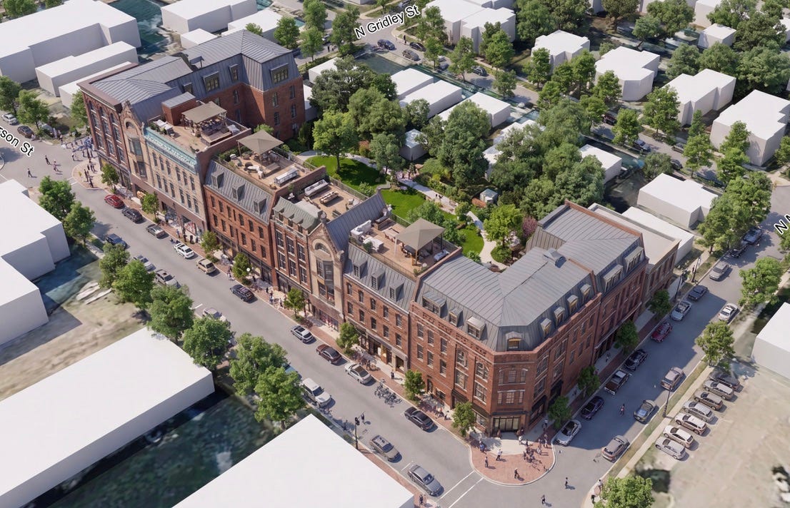
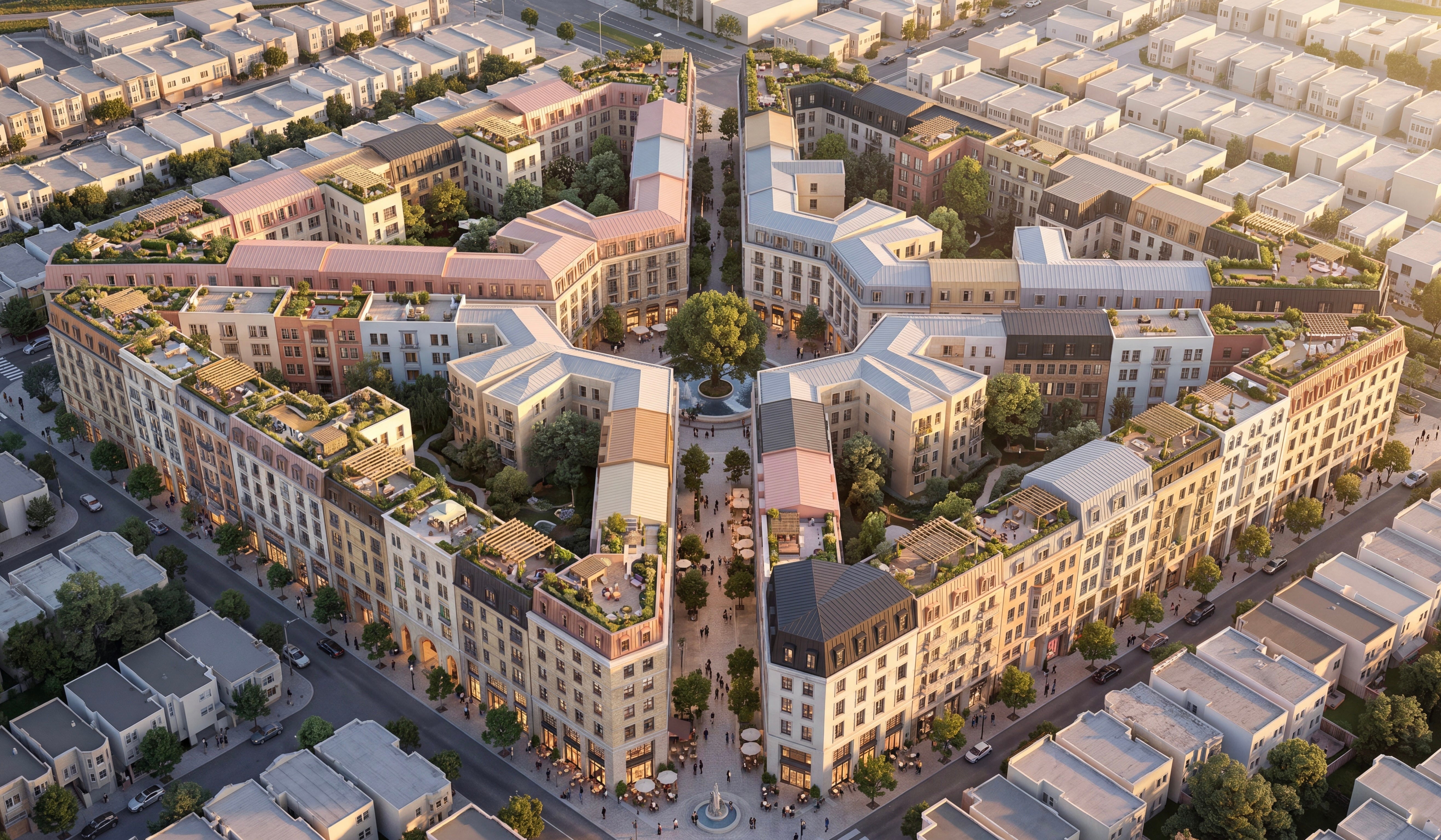
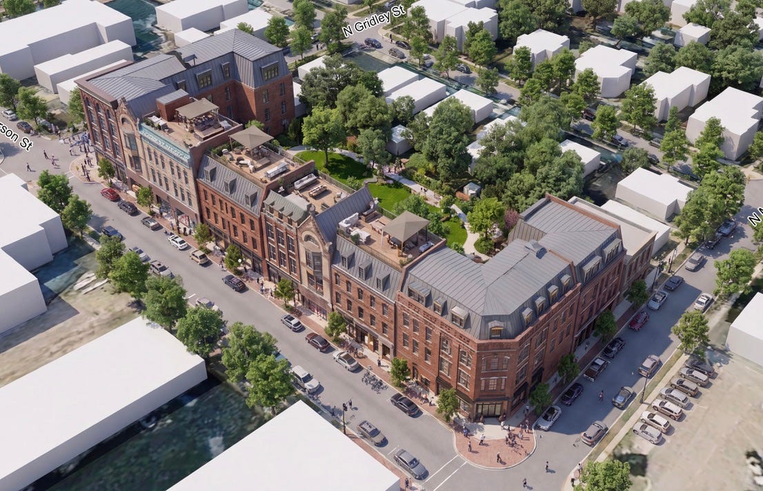
Courtyard urbanism is a version of the same idea, sized for a downtown transitional district instead of one boulevard. A perimeter block can reach real density at four, five, or six stories without being one building and one development deal. Divide it into many buildable parcels instead. Each building contributes a stretch of street wall and encloses part of a shared courtyard, and different architects, developers, contractors, nonprofits, cooperatives, and owners can all take part without breaking the coherence of the whole.
The block is the unit of urban design. The building is the unit of development. That distinction is what lets density grow incrementally and hold people across the life cycle, instead of resetting to zero every time one megaproject stalls.
A high-agency urban revival group brings courtyard urbanism to their city
Strong Towns BLONO started in 2022 as the Bloomington Revivalists and has grown into an independent nonprofit whose members include teachers, contractors, planners, professors, real-estate professionals, small-business owners, and elected officials. Members choose priority campaigns and build projects around them — a downtown tax-assessment map, a crash-data explorer, a sidewalk wayfinding mural pilot, zoning advocacy, and last summer’s charrette for the city-owned Front N Center site, where sixteen volunteers spent a day producing low-, medium-, and high-intensity redevelopment concepts for a since-demolished downtown block.
Noah Tang leads the group with a rare skill set, which includes an understanding of urban development and a knack for teaching and coordinating. Under his leadership, the local advocacy group has evolved beyond a reactive (“gives feedback on proposals after they’re already designed”) group. It is helping generate the designs.
That’s the context Noah invited me into.
Teaching a form, then going for drinks
That first evening began with maps. The public could examine the transitional district and talk through specific sites with the charrette team. Their input could then feed directly into the next day’s design work in a natural, sequential fashion.
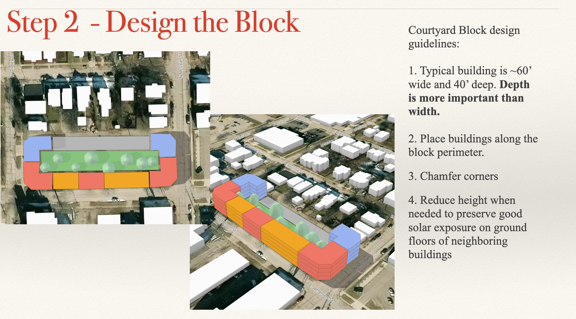
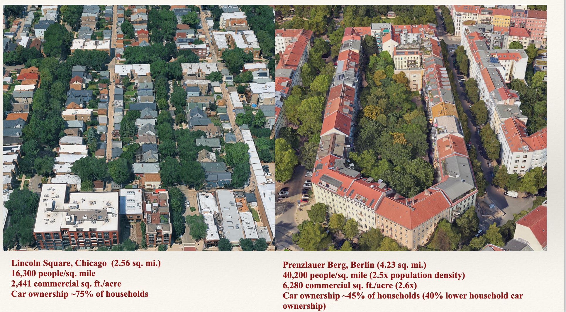
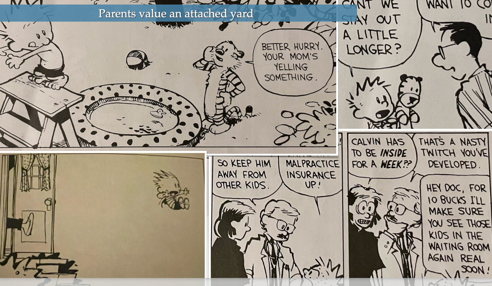
Then I gave my keynote, a ~45 minute presentation on courtyard urbanism + 15 minute Q&A. I explained how mid-rise perimeter block creates neighborhoods that are dense enough to support walkability and amenities, and green enough for kids to have backyard experiences. I showed how mid-rise perimeter blocks can hold house-like apartments with multiple bedrooms, dual-aspect plans, frequent entrances, usable outdoor space, and a clear sequence from public street to private home to shared courtyard. I argued that the courtyard block is a development system that lets many buildings and many builders assemble one coherent neighborhood incrementally over time. I argued that courtyard urbanism is the solution to cities’ family urban exodus problem — and the means by which historically gutted cities like BLONO can create fantastic live-work neighborhoods that appeal to households of all ages, stages, and incomes. I showed them how to design the blocks. It was a great audience, and they had great questions and comments.
Then we went for drinks! Local development gets shaped by plans and ordinances, but also by relationships, and the people in that room were good-humored and willing to spend a weeknight talking about parcel dimensions, party walls, and urban history—my favorite things.
The next morning the charrette began in earnest. The study area was split into four quadrants, and we were divided into four teams and assigned to a quadrant. We walked the streets looking at the city-owned lots, parking lots, historic structures, and awkward cell towers. Back at the maps, we covered them in tracing paper and started drawing.
While others worked fluently with markers and physical materials, I shifted to my laptop and started testing building footprints on screen. I’m a hopelessly digital person in a beautiful, analog ritual. My contributions focused on the city-owned sites already positioned for redevelopment. I subdivided these sites into parcels roughly 60’ of street frontage, and then traced the shallow footprint (40’ deep), and chamfered any corner lots.


The activity is revealing the latent urban structure already present in a city block How to divide the street frontage into multiple parcels?
A charrette report should be a beginning, not an ending
Strong Towns BLONO is still finishing the output of the 2026 charrette, which is likely a draft proposal or packet assembling the site analysis, drawings, and recommendations from the three-day process (the charrette continued on to Saturday, although I returned to Chicago on Friday).
The recommendations will go into 2026 report that the Planning Commission will take guidance from as they make plans for the transitional district.
The next step is bringing the report into a sustained conversation with Bloomington’s planning staff, Planning Commission, mayor, City Council, land-disposition officials, and property owners. The city’s comprehensive plan already calls for downtown to function as a vibrant commercial, cultural, and residential neighborhood, and the city has recently amended its own Downtown Transitional District regulations.
What it the best possible outcome for the charrette? I think it should become the starting point for three linked pieces of development infrastructure: (1) A pattern book of pre-reviewed buildings; (2) a mission-aligned parcel passport system that specifies boundaries, building envelope, height, frontage, access, parking, open-space and environmental obligations—and often its intended housing type or tenure; (3) a pilot courtyard block district.
1. A pattern book of pre-reviewed buildings
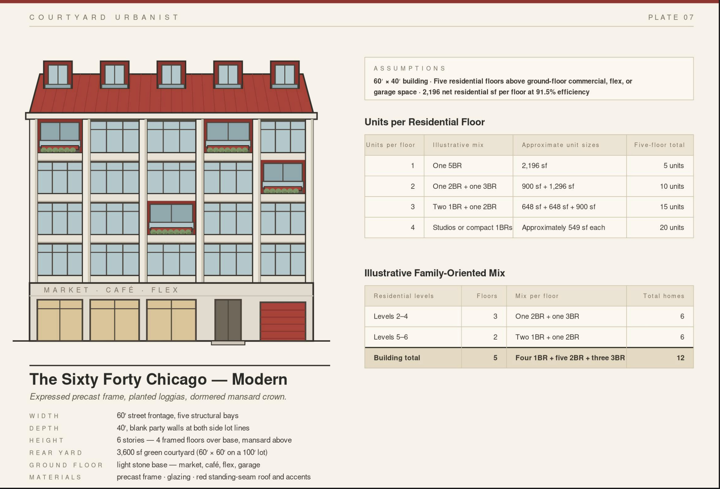
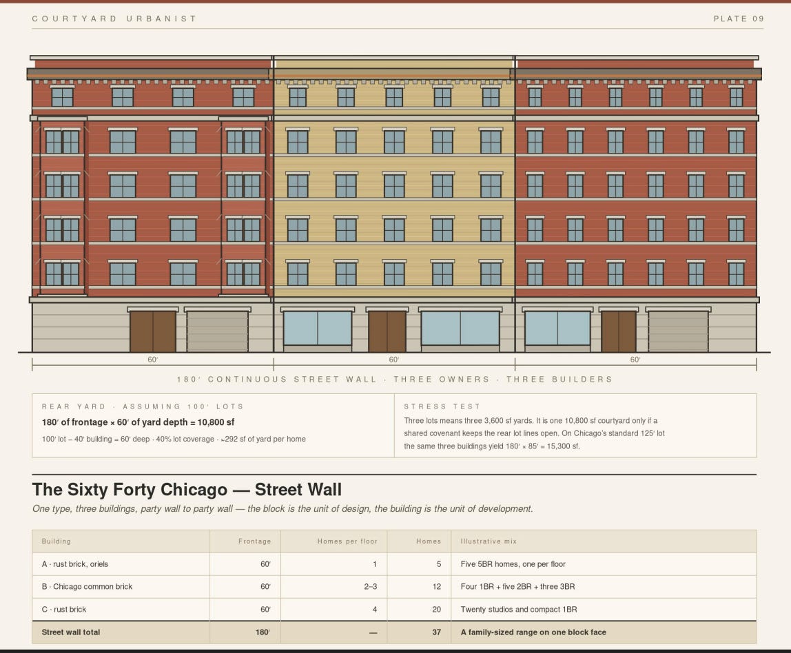
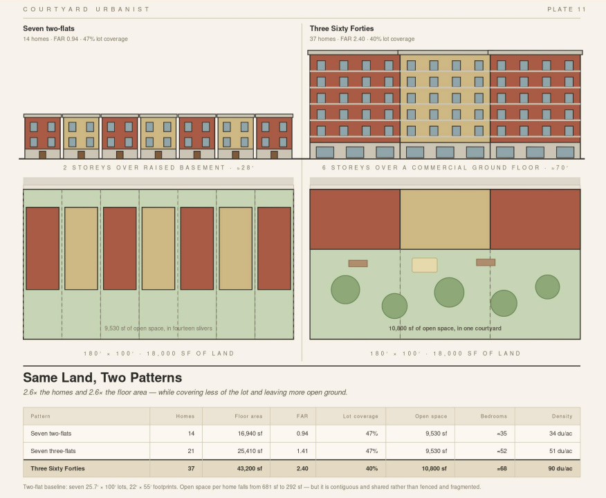
A pattern book would define a family of middle housing building types suited to Bloomington. These shouldn’t be surface-level façade designs. They should set the spatial and architectural rules that create fine-grained neighborhood with adequate green space: building depth, frontage, party-wall conditions, entrances, stair and elevator configurations, unit orientation, ground-floor relationships, courtyard edges, corner conditions, roof forms, and adaptable mixed-use space.
Selected plans could then get advance review for compatibility with local zoning, building code, fire access, utilities, and design standards. Pre-reviewed means the city has resolved the recurring questions once, and this cuts design cost and approval uncertainty, which comes as a special relief for small developers.

2. Parcel passports
Pair those building types with parcel passports for priority redevelopment sites: a site-specific license that tells a prospective builder what can be built. That might include parcel dimensions, ownership and disposition process, allowable building envelope, utility connections, access and servicing conditions, environmental or historic constraints, parking and loading rules, applicable incentives, approval sequence, and which pre-reviewed building types fit the site.
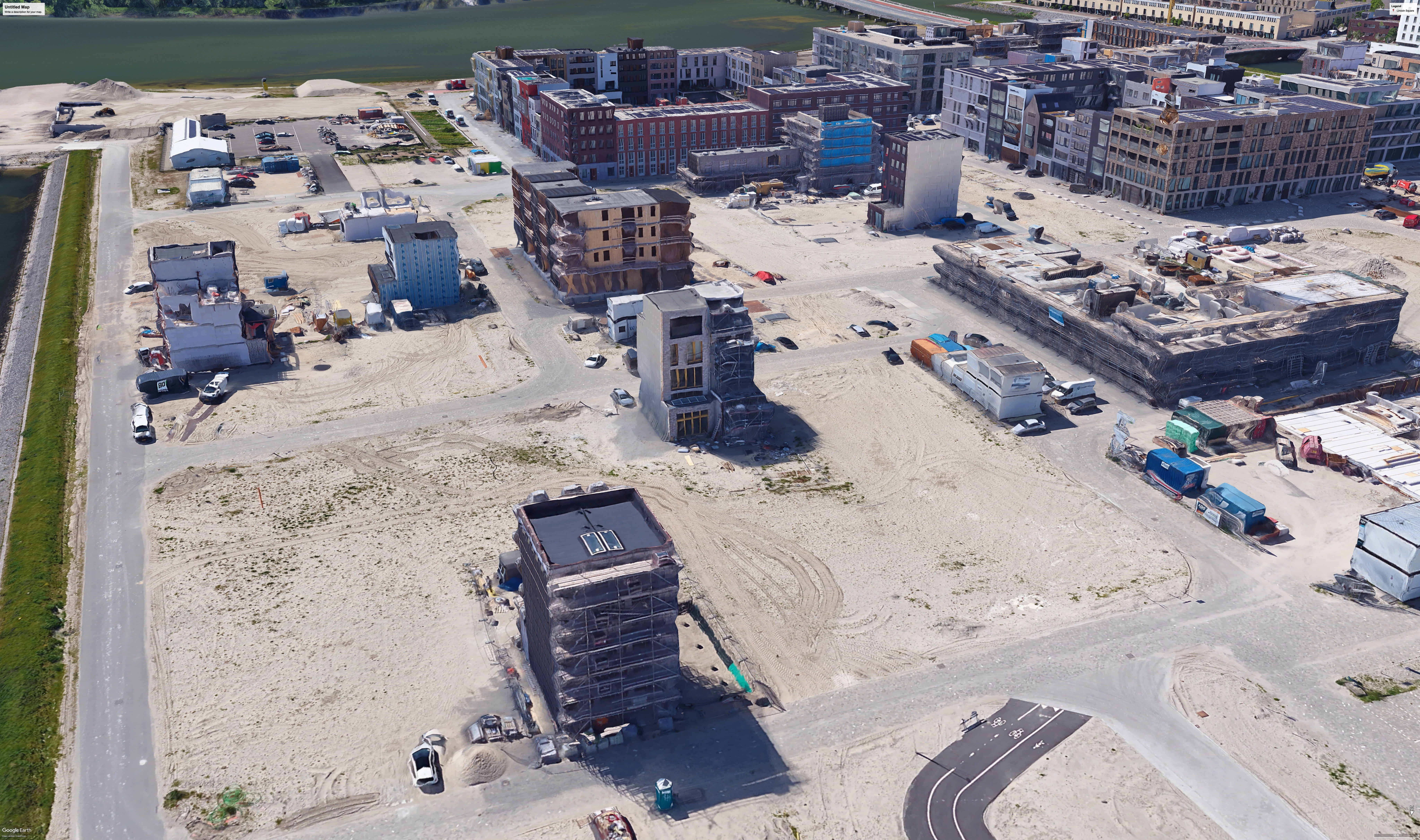
At Amsterdam’s Centrumeiland, the city subdivides large blocks into smaller plots and issues each one a parcel passport, enabling households, cooperatives, housing associations, and developers to build individual pieces while the city coordinates the form, infrastructure, tenure, and affordability strategy across the block.
Cities routinely advertise land as “available” and leave the developer to discover months later that the site has an unresolved title issue, inaccessible utilities, or an approval process no one can explain. A parcel passport turns municipal land from a vague opportunity into a development-ready product.
3. A pilot courtyard district
Finally, Bloomington should designate a small pilot area to test the whole system at once: the charrette plan, a fine-grained parcel map, pre-reviewed building types, parcel passports, public-realm improvements, a predictable approval path, and a transparent process for disposing of city-owned land.
The objective is to replace fragmented and uncertain with one coherent set of standards built around the neighborhood the city wants. A handful of buildings would test the pattern book, one block would test the shared courtyard and parcel structure, and the district as a whole would test whether multiple developers can build side by side, with room to adjust before the city extends the model further.
That is how a charrette becomes an implementation program
A playbook for bringing courtyard urbanism to your town
The Bloomington-Normal experience offers a sequence other communities can copy.
Start with a capable local organization, such as a Strong Towns local conversation, a housing advocacy group, a neighborhood association, a preservation group interested in constructive infill, or a coalition of residents and small developers.
Pick a real place, such as a publicly owned parking lot, an underused commercial property, a dead mall, obsolete institutional land, or a redevelopment parcel too important to fill with another isolated apartment complex.
Invite a broad but working group — residents, architects, builders, developers, planners, elected officials, lenders, housing advocates, business owners, critics — and structure the event around building a vision with broad appeal.
Teach the building form before asking people to draw it. Most Americans have never had a vocabulary for telling a freestanding apartment complex apart from a perimeter block, or a unified megaproject from an incrementally built neighborhood. Once people know the parts, they can make better choices about them.
Walk the sites. Draw the blocks. Test dimensions. Identify the publicly controlled parcels. Publish the results. Then use the charrette to launch the three pillars: pre-reviewed plans, parcel passports, and a pilot district.
A charrette doesn’t resolve financing, rewrite the zoning code, remediate a site, or persuade a city to sell its land differently. A charrette sets the table. It turns a foreign, unknown kind of development into something people can talk about concretely, gives residents something more specific than the word “density” to react to, shows officials that a parking lot is a future neighborhood and not just a future project, and gives builders a sense of which pieces of a big site they could actually take on themselves. It also hands a local organization a positive agenda instead of a defensive one.
Bloomington-Normal already has the jobs, the institutions, and the infrastructure. The work now is building the neighborhoods that connect them.
If you would like to organize your own charrette and want to learn more about how to do it, you can reach out to Noah Tang at president@strongtownsblono.com.
If you want to find out more about engaging me for presentations and workshops, you can send an email to projects@courtyardurbanist.com
Alicia, thank you for attending our charrette! We are very excited to continue our work and hopefully see tangible changes to our community.
We this process to be repeatable by other groups, so if anyone is interested, send me an email at president@strongtownsblono.com
I love this so much. I'm going to share this in a few groups I'm in and see if anyone bites.