
The greenway
A planted pedestrian route connects the piazza with the waterfront district. Buildings turn their corners toward the route, giving it doors, windows and places to stop.

WASHINGTON, DC · ANACOSTIA RIVER
A neighborhood on the Anacostia.
Independent concept study
City streets. Courtyard gardens.
A generous public life at the water’s edge.
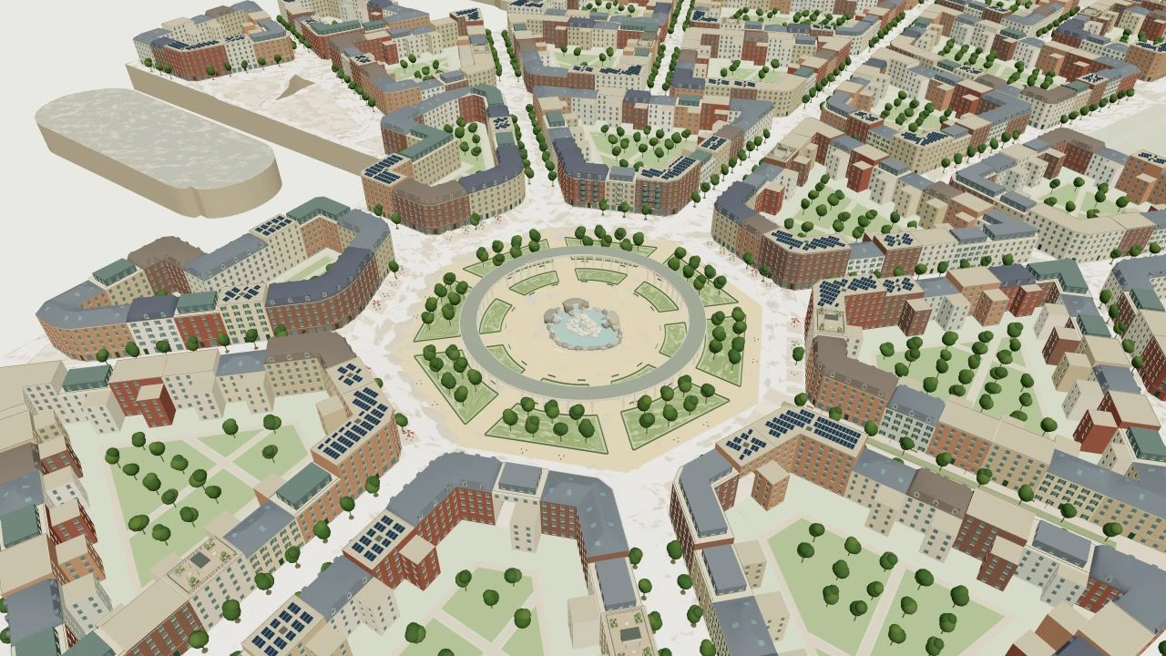
THE IDEA
RFK becomes a neighborhood of individual apartment houses, sheltered gardens and streets that lead to the river.
The study brings four- to six-story buildings together around planted courtyards. Shops and cafés gather at a landscaped piazza, while a pedestrian greenway leads toward the quay. A colonnade frames the fountain and gives the square an outdoor room of its own.
Brick, pale stucco, bay windows and recessed loggias draw on Washington’s architectural character. Mansards, standing-seam roofs, garden terraces and solar arrays give the skyline variety.
EXPLORE THE DESIGN
Follow the streets, look into the gardens and study the roofscape in the public 3D model. The views below come from the same current architectural geometry.
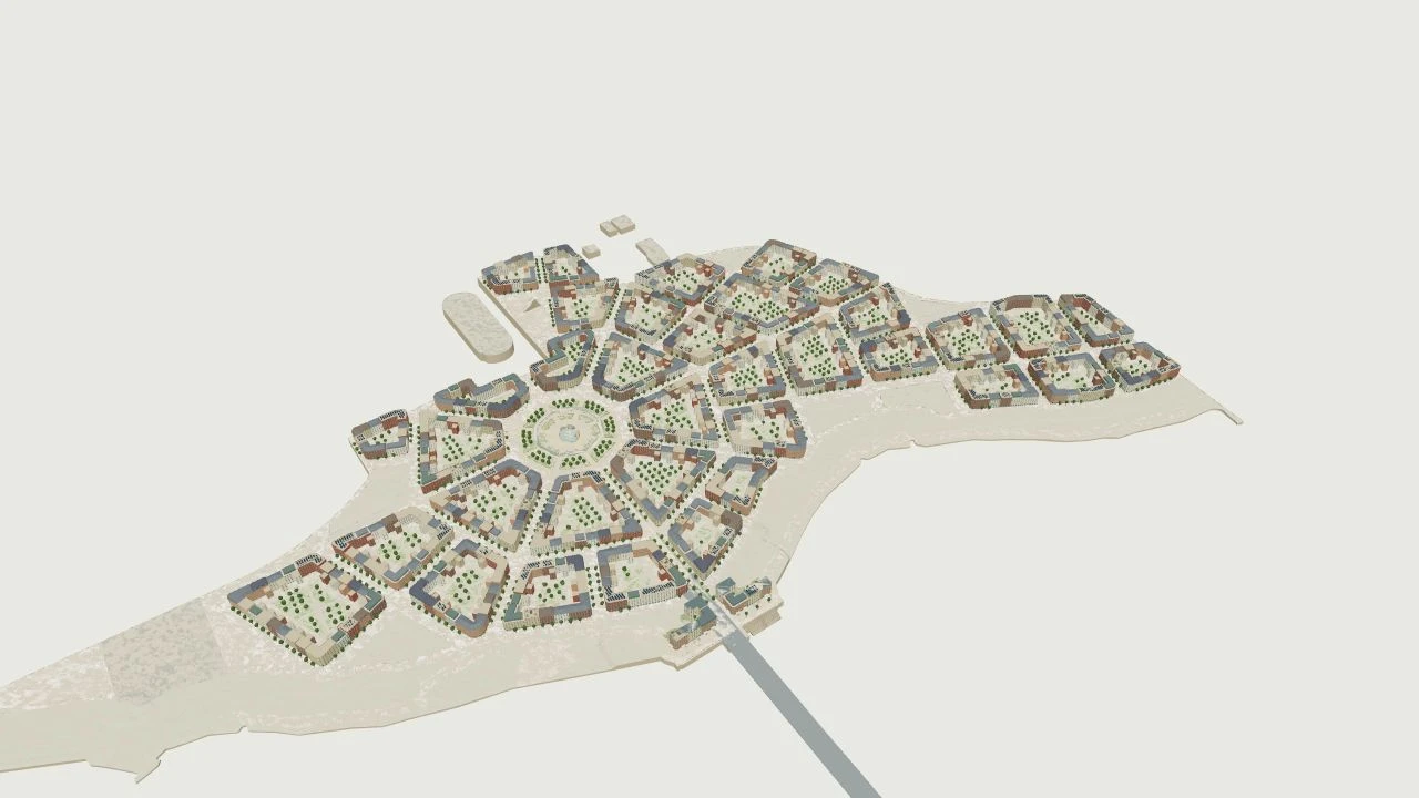
The full-detail model is in Google Earth. It includes the architecture, planted courtyards and varied roofs. It is a large model and may take time to load, especially on a phone.
LIFE AT THE RIVER
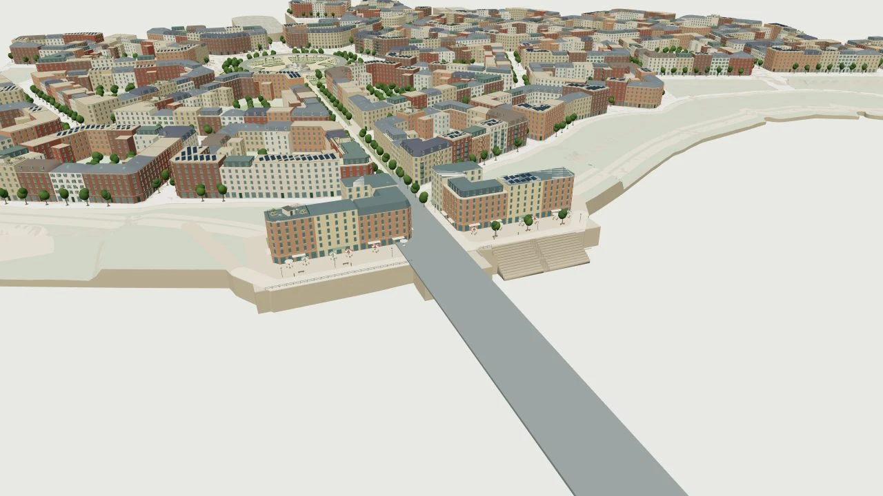
A planted pedestrian route connects the piazza with the waterfront district. Buildings turn their corners toward the route, giving it doors, windows and places to stop.
Café tables, umbrellas and gardens surround a ring of columns. At its center, an Anacostia fountain celebrates freshwater mussels, fish, birds and reeds amid large, uneven boulders and cascading ledges.
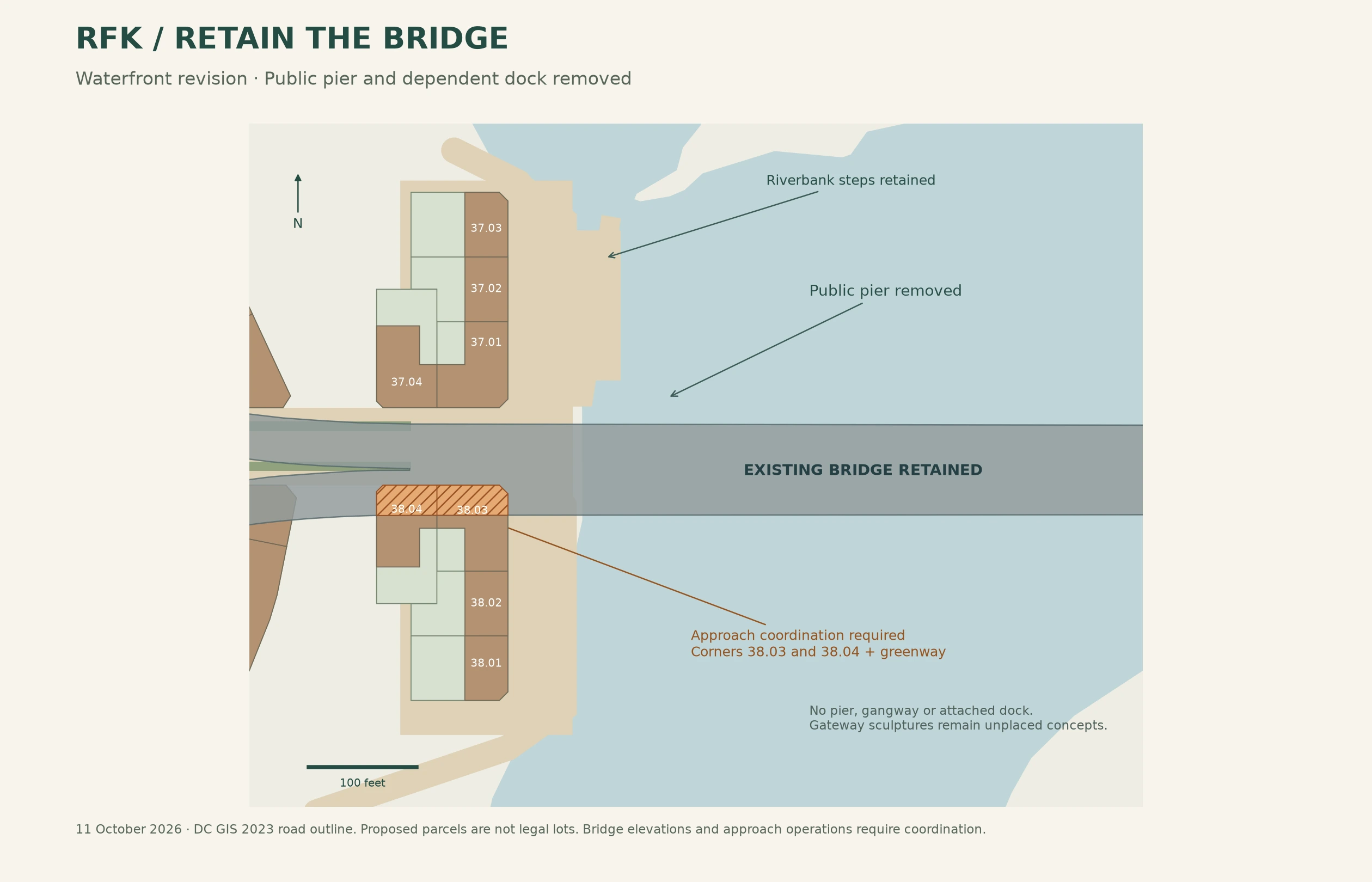
Homes and commercial frontages meet the waterfront. Broad riverbank steps remain in the concept. The existing bridge is retained; the earlier public pier and its attached dock have been removed.
River guardians: Anacostia and blindfolded Lady Justice are the adopted sculptural concept. Their locations are still being studied; they are not placed in this model.
THE SITE PLAN
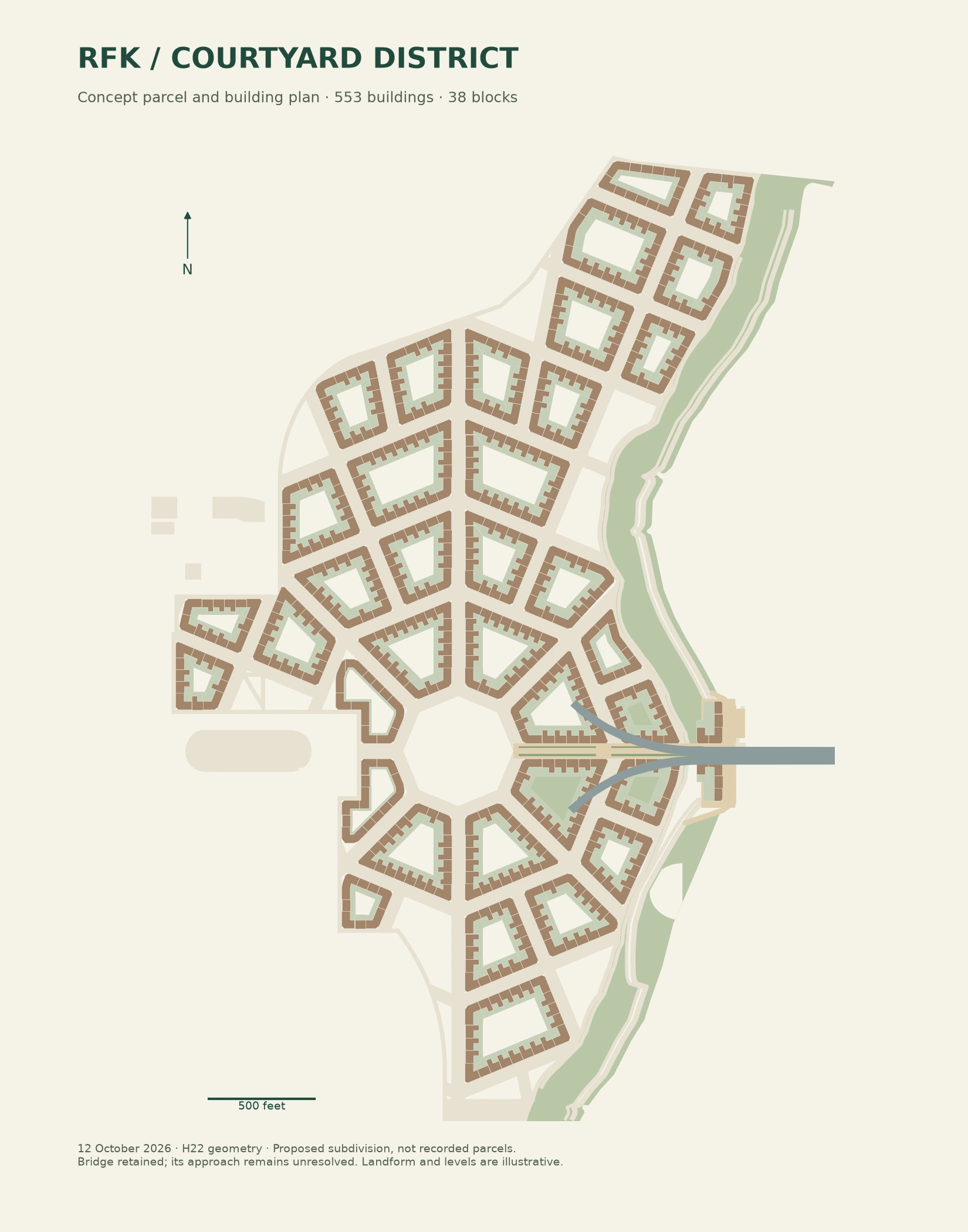
Individual buildings join along the street. Chamfered corner buildings turn the block, while inward wings shape shared gardens and retain useful courtyard space.
Quieter mid-block façades balance the more prominent corners. Parking is conceived below ground, with discreet access at a far corner of each block.
AREA & PROGRAM
| Program | Approximate area |
|---|---|
| Building footprints | 1,869,826 sf |
| Modeled gross floor area | 9,359,829 sf |
| Residential gross floor area | 8,892,372 sf |
| Ground-floor nonresidential | 467,456 sf |
| Net dwelling area | 8,092,059 sf |
| Area-based home equivalent | ≈8,990 homes |
ABOUT THIS STUDY
This is an independent Courtyard Urbanist design study, not an approved RFK redevelopment plan. The page presents the current bridge-retained geometry and buff-brick quay revision.
The bridge footprint is mapped context; its deck elevation and the surrounding grades are illustrative. Two quay buildings (38.03 and 38.04) and the greenway require coordination with the bridge approach. Circulation remains unresolved in buildings 35.10 and 36.09.
Survey, floodplain, access, infrastructure, engineering, approvals, parking capacity and financial feasibility have not been established by this model. No new statue location is adopted.
Published 12 October 2026 · Architecture H22 · Sculptural direction H23
YOUR SITE. ITS POTENTIAL.